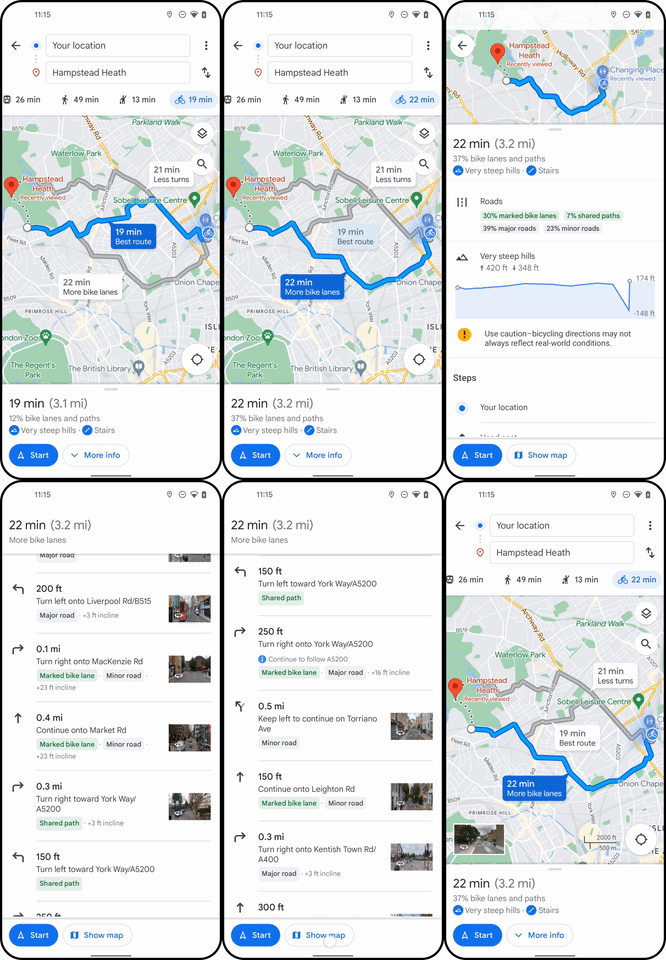
Google Maps has updated its cycling navigation feature to provide more information on the road ahead, enabling you to avoid congested roads and high gradients.
The mapping tool previews possible routes in greater detail so you can make a more informed choice about which way to go.
Google Maps will suggest what it calculates is the ‘best route’ based on data including traffic, road type (for example, percentage on bike lanes) and number of turns, according to Google.

Google claims up-to-date traffic information will inform its new Maps cycling feature, so you can dodge traffic jams.
This is not something the best bike computers offer. So it’s worth considering if you’re weighing up the merits of a bike computer vs smartphone vs smartwatch.
Because the update incorporates aspects of the best cycling apps, navigating via Google Maps with your phone in a bike phone holder could be a viable alternative to purchasing a new device.
Now Google Maps predicts the elevation of route options, you can choose the flatter or hillier way, if you prefer.
When route planning on Strava, you can maximise or minimise elevation.
Google says its route preview will highlight steps, stairs and steep hills, much like on Komoot.

Another parallel with Komoot is Google Maps’ new road type breakdown. It is claimed to show what proportion of the route is on bike lanes, minor and main roads.
Cyclists may also benefit from Google Maps’ new location sharing notification.
Google says you can set up the app to notify a friend or family member when you return to a chosen spot.
For riders, this could be a mountain bike trailhead or simply your home.
