Komoot is a navigation and route-planning app that enables users to create and follow routes based on riding type and ability.
Designed to help users explore new places and discover new routes, as well as provide ride recommendations through its ‘community’ of riders, Komoot is one of the most popular route-planning apps on the market and has many functions that are designed to make route planning an easier experience.
As cycling has shifted more towards adventure riding, exploration and gravel riding, Komoot has proven popular with cyclists thanks to its easy interface and robust route-planning algorithm. It is included in BikeRadar’s list of the best cycling apps and is compatible with the best bike computers.
What is Komoot?

Komoot is a route-planning and navigation app. It enables you to plan routes on your phone or computer and will generate routes based on riding type, surface and rider ability.
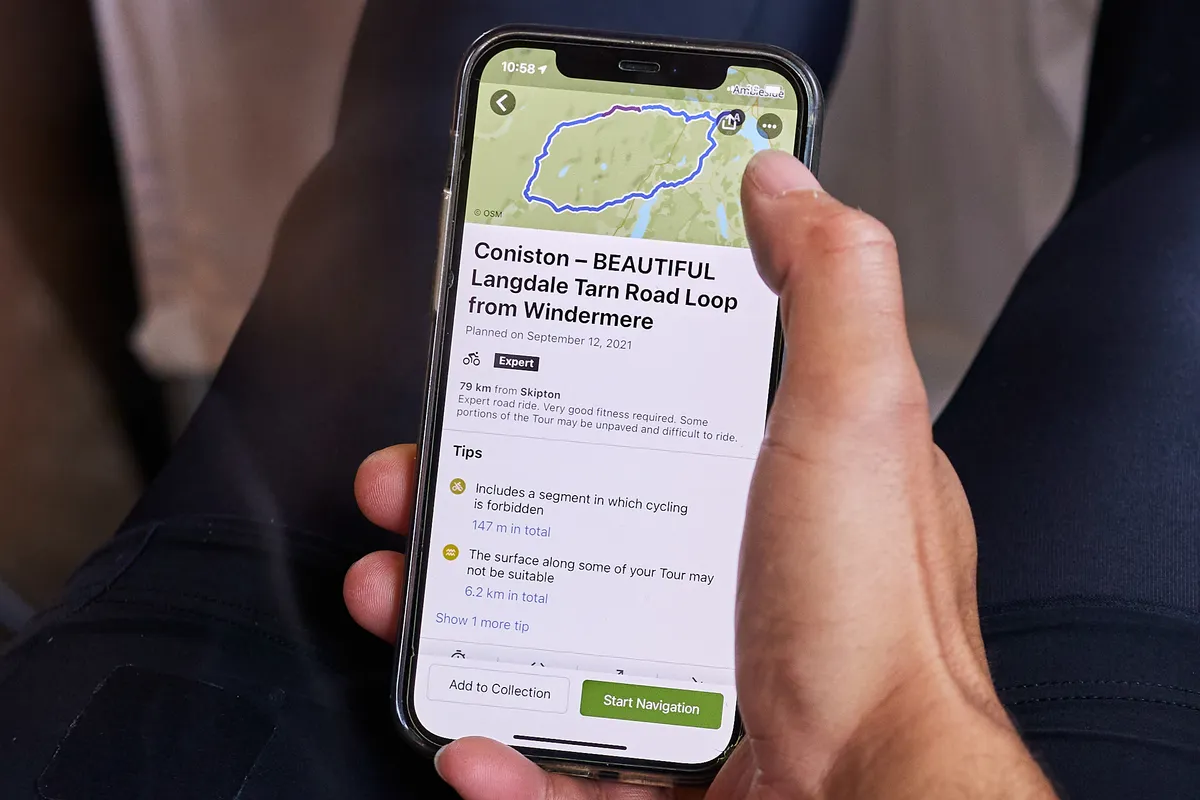
Using a start and end point, Komoot will tell you the distance, elevation profile, road surface, fitness level required, difficulty and estimated time needed to complete the route.
You can use these routes to navigate via your phone, GPS cycling computer or Garmin cycling watch without an internet connection.
If you have access to an internet connection or mobile data, Komoot also enables you to reroute when you are out on a ride if you decide you want to head somewhere different or just change course.
The app also has a strong community focus. This means you can discover places other users like to ride or visit (‘Highlights’ in Komoot parlance), such as particular climbs, cafes or points of interest, and integrate these into your ride. You can use routes they have planned too.
Komoot is available to use on desktop via the Komoot website. You also download Komoot for iOS or Komoot for Android.
How does Komoot work?

Komoot utilises the open-source OpenStreetMap database for its base mapping but then uses its own algorithms to establish the best route depending on activity type, selected waypoints and points of interest.
Komoot provides map overlays including an Open Cycle Map that shows national cycleways and a Google satellite map. You can also upload GPX or FIT route files to Komoot.
Once a route has been selected, Komoot will give you onscreen and audible navigation in an offline mode to save the battery on your device. You can also send routes created on Komoot to your compatible cycling computer for navigation.
When riding, the Komoot app will tell you speed, distance travelled, distance remaining and enable you to alter the route on the fly.
When you have completed your ride, you can upload it to your Komoot profile and add photos.
Komoot will also feature local highlights, as suggested by users and Komoot ambassadors.
Komoot can be used on a computer (PC or Mac), iPhone, Android phone, Garmin, Wahoo and most wearable devices, such as Apple Watch and Android Wear.
How do I get started on Komoot?
To start using Komoot, you will need to set up an account.
On a Mac or PC, you can do this via Komoot's website. On a smartphone, you can do it via the Komoot app, which you can download from the Apple App Store or Google Play.
You can start using Komoot for free straightaway, planning routes and navigation. You can also pay to download maps for offline use.
Komoot also offers a Premium account that's aimed at adventurers and those looking to complete multi-day trips.
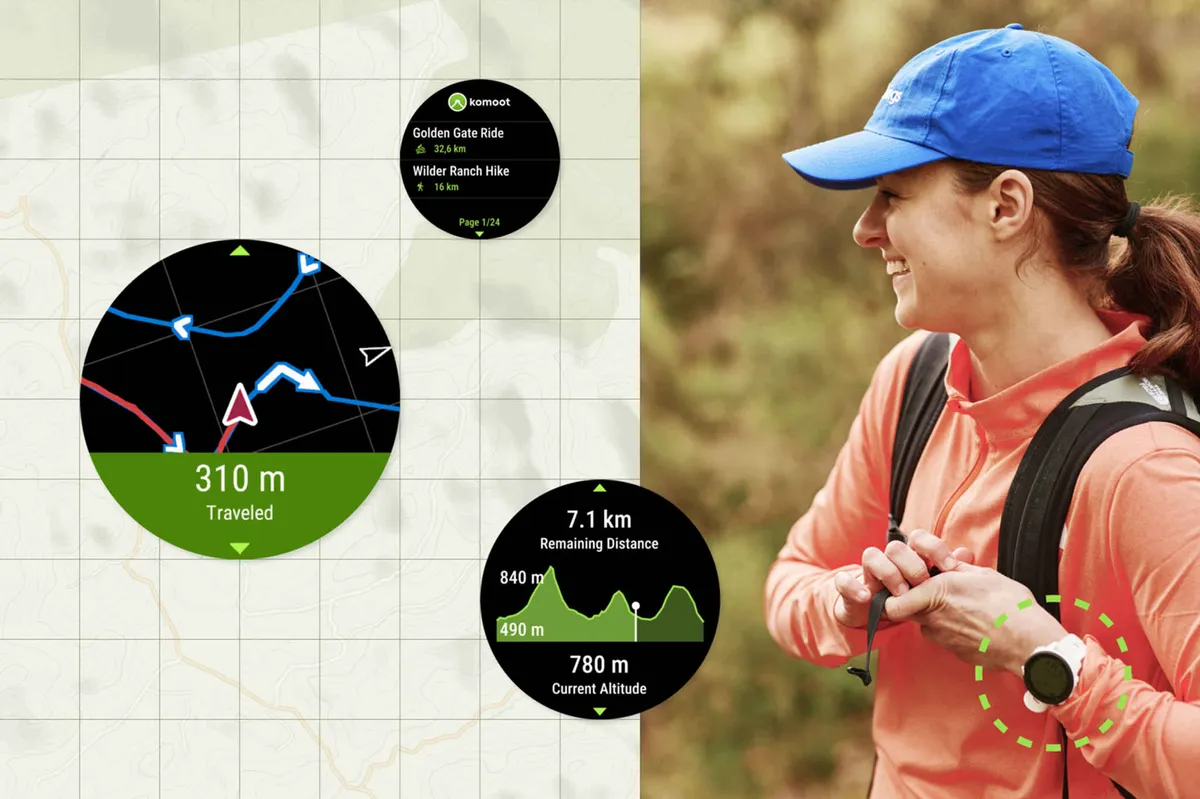
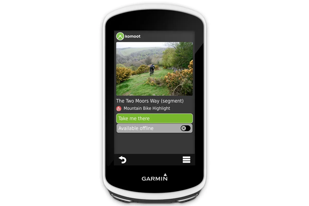
Once you are set up with a Komoot account and the app, you can integrate Komoot with your Garmin or Wahoo device to send it routes.
Komoot has a proprietary app for Garmin that can be downloaded through the Garmin Connect IQ store.
For Wahoo, all you need to do is go to your Wahoo app, head to connections and log in to your Komoot account. You will then be able to access routes and sync your rides to the Komoot app.
How do you plan a route using Komoot?

To create a route on Komoot, go to the Route Planner tab on the website or in the mobile app and hit the 'Plan new' button.
Then search for a destination and a starting point and the Komoot algorithm will calculate the best route either as an A to B journey or a round trip.
You can select your chosen riding discipline (road, gravel or mountain bike for instance) and Komoot will adapt the route to best suit whatever bike you’ll be riding.
Adjusting the fitness level on a sliding scale from Untrained to Pro will affect how long Komoot says the route will take you.
You can add additional waypoints to your ride – for example, if you want to pass through a particular place or complete a certain climb – and Komoot will suggest the best route to include these.
The Komoot map also shows points of interest, amenities and highlights submitted by users (shown as red pins with bicycles on them). If you add these to your route, Komoot will adjust the route to include these too.
Komoot will use its own mapping based on activity type to decide on a route, but you can plan a route using an 'Off-grid' function that will let you ignore Komoot’s network.
This won’t always be useful – and might be better if you’re using Komoot for running or hiking – but it could be good if you know a path or road exists, or you have seen one on another map or satellite view.
Komoot will show a breakdown of how long the route will take to complete, elevation, descent, its difficulty and the distance spent on each way type and surface.
You can also select the option of prioritising official cycle routes by selecting 'bike touring' should you wish to stick to recognised cycleways.
With the premium weather feature, you can also plan routes that make the most of tailwinds should you wish to harness one to your advantage.
Multi-day routes can also be found in Tours by selecting 'bikepacking', giving you the option of selecting a route depending on how many days you'd like to be riding and what type of bike you'd like to do it on.
Once you have decided on your route, with as many added features, waypoints and detours as you desire, you can save the route to your profile. It will then be available to use for navigation, send to a device, download as a GPX file or share with your riding buddy.
Komoot has also released a bank of ready-made gravel routes that contain 160,000 (and counting) pre-planned routes across all regions.
These routes can be edited to suit your start or end point and saved for later if you don't fancy tackling them right away.
Similarly to Komoot's road routes, riders can upload photos and rate gravel routes, enabling them to continuously improve over time.
On the iPhone app, routes can also be found using Siri or Spotlight Search, making it quick and easy to find a route if you're in a rush.
Desktop vs app for route planning
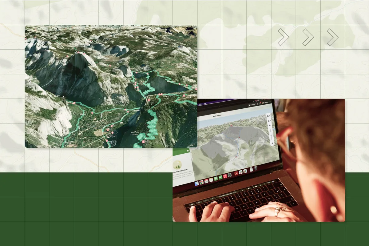
You can plan routes on Komoot on either a mobile or desktop device, but it's probably worth considering using a desktop for in-depth planning because this gives you more room to see your route and enables you to dive deeper into the functionality Komoot provides.
Certain paid-only features, such as Trail View and 3D Maps, are available exclusively on desktop.
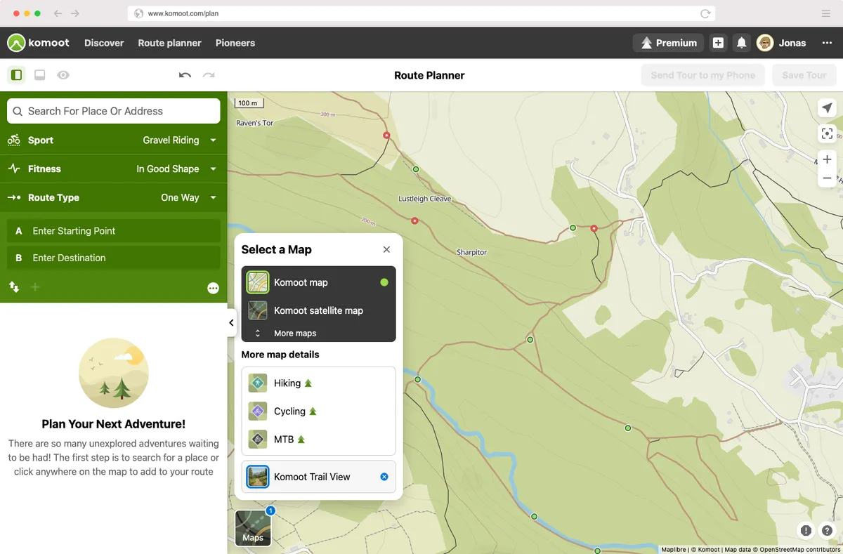
Trail View harnesses AI to match images of trails or roads uploaded by users to their location. Green dots indicate where these are on the desktop map. Clicking on one brings up a photo of the surface, enabling you to preview the terrain before you ride it.
The 3D view on the desktop route planner permits you to scroll in three dimensions through a landscape in the Komoot map or satellite layer.
However, Komoot satellite map view is now available on the iOS and Android apps. Tap on the bottom right-hand corner of your phone screen to switch to satellite view to get a clearer idea of where you'll be riding.
The desktop site also shows Google Street View so you can see roads as they really are.
Komoot has also added Highlights warnings to the mobile app. These alert you if your tour includes a dangerous segment, such as a steep descent, or a national park where you may need to adhere to certain regulations.
How do you navigate using Komoot?
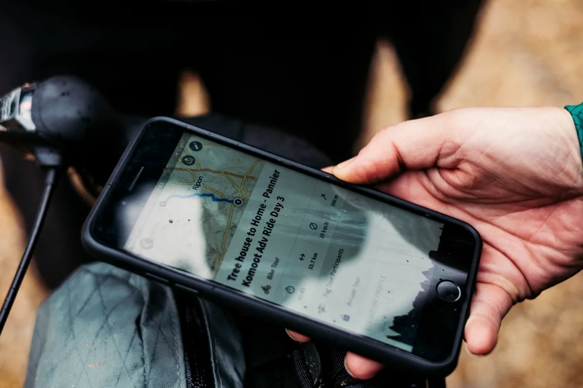
Komoot can help you navigate in a number of ways, either by linking up to a cycling head unit or directly on your mobile phone.
Phone navigation
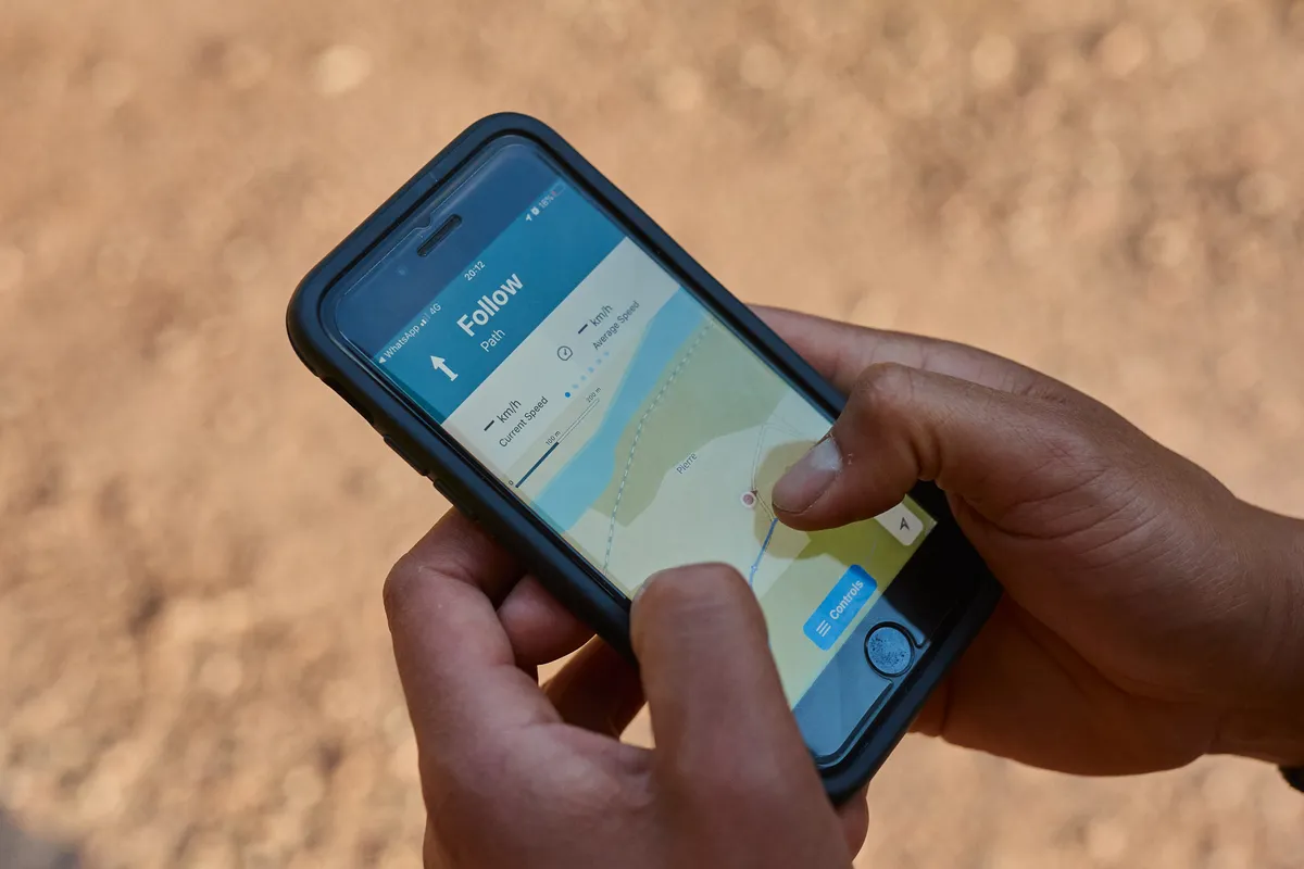
If you are using a phone, you simply select the route you wish to follow and hit the 'Start Navigation' button.
Komoot will then give you visual and audio turn-by-turn directions, so you can either listen through headphones or use a bike phone mount for on-screen directions.
Komoot gives one free region for users that will provide navigation offline, but if you are venturing further afield you will need a data connection.
Alternatively, you can buy maps. This is particularly useful if you want to save the battery life of your phone, save money on data when cycling abroad or explore places without phone signal.
If you want to change where you are going while riding, you can simply select the location on the map and Komoot will reroute for you.
Cycling computer navigation

Once you have synced your Komoot app to your cycling computer, you will be able to follow any routes you have planned via your head unit.
Any changes you make to the route via the app will be updated on your device, even as you go. You just need to replan and resync.
How do you upload your ride to Komoot?
Once you have completed your ride, it will automatically sync to your Komoot profile as a private activity, or as Komoot calls it, a 'Tour'.
You can then go into the Tour, name it, add photos and share it with other Komoot users. You can also select certain points on the ride and make them highlights, playing your part in the Komoot community.
Our list of 12 lesser-known UK cycling highlights has links to relevant Komoot routes to give you an idea of what sort of rides you can discover when using the app.
What is the Komoot community?

Since it was founded in 2006, Komoot has grown to more than 20 million users worldwide.
Referring to users as a community might seem like a stretch, but it begins to make sense when you consider that Komoot’s power comes through input from its users.
As already mentioned in this guide, the Highlights function on Komoot enables you to find out about particular climbs, roads and points of interest wherever you’re looking on the map.
Users are encouraged to add these highlights and to include pictures and descriptions to help other users find out more about an area they may not know, which is particularly useful for bikepacking.
Other users can then add their own descriptions – almost like reviews – and pictures to these highlights, and can upvote or downvote the highlights too.
Komoot also enables users to explore routes or Tours created by others, seeing highlights and images from a ride as well as descriptions, and use these for their own rides.
Komoot may appoint a particular user as a Pioneer. Pioneers are users who find 'the most beautiful Highlights' and 'share their expertise', helping other users in the process.
As the number of users increases, Komoot should become a richer and richer resource for route planning.
Komoot vs Strava

Strava and Komoot are the dominant ride-sharing apps, offering functionality to enhance route planning, riding and post-ride analysis.
While both apps appear to have a similar focus, their emphasis is rather different, with Strava appealing to those looking more for performance tracking and Komoot serving those interested in the overall ride experience.
For ride tracking, both use the GPS data from your cycling computer or, in the app, your phone's GPS signal.
As well as recording your ride, both give turn-by-turn visual and audio route instructions on your phone, so you can follow a pre-planned route.
There's also live tracking on the phone with Strava Beacon, with a similar function available on Komoot for paid users.
Komoot enbles you to plan routes using the free version of the app, while Strava now requires you to subscribe to access its route-planning service.
Strava's tracking of performance metrics has also been put behind the paywall, with its segment leaderboards and performance analytic tools now reserved for subscribers.
'Highlights' is Komoot's equivalent of Strava's segments, although instead of posting fastest times, you can document the stretch with pictures and text.
Our Komoot vs Strava guide examines the differences in more detail.
Komoot vs RideWithGPS
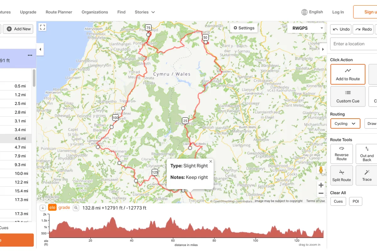
RideWithGPS is another popular route-planning app best suited to those who like to spend hours carefully planning rides.
Compared to Komoot, it’s more user-friendly if you like to create routes waypoint-by-waypoint, particularly if they cross unmapped trails. The ability to draw lines freehand, rather than follow defined routes, helps here (Komoot offers similar functionality, but its implementation is a bit clunky).
Editing existing routes – either made in the app or based on imported GPX files – is also easier in RideWithGPS.
RideWithGPS offers 11 map layers as standard in its free plan. Komoot only offers four, with three additional layers available as part of a premium subscription.
RideWithGPS features none of the crowd-sourced routing automation that defines Komoot as an app – while it offers heatmaps, these tell you little about conditions on the ground.
Where Komoot provides helpful insights in the form of highlights, RideWithGPS includes no such information. Any research must be done off-app.
A basic RideWithGPS account is free to use, with two paid tiers offering additional functionality.
How much does Komoot cost?
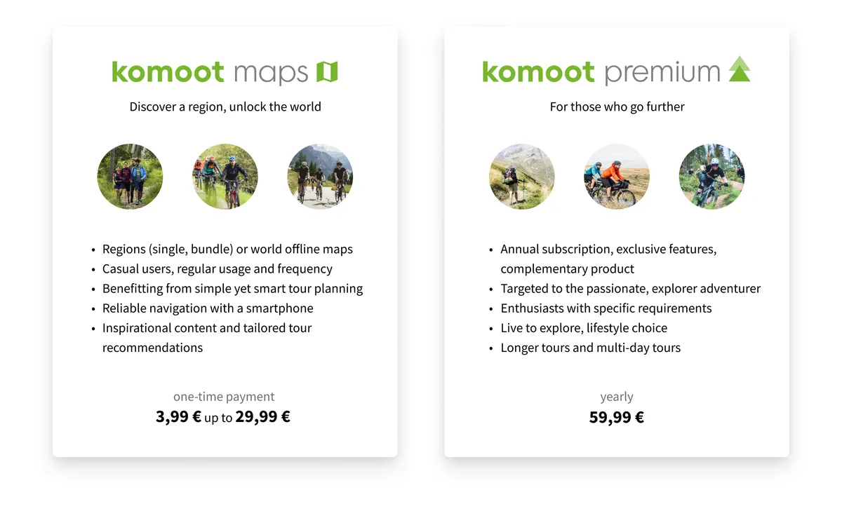
Komoot is free to use as soon as you set up an account, but there are various packages and in-app purchases you can make to enrich the experience.
Komoot maps
Komoot maps is the free version of the app. You can plan routes, upload rides and create highlights, and use the social aspect of the app to comment on and like other users' activities. Navigation is also free but only with a data connection.
You can download maps of regions to navigate and reroute offline. It costs £3.99 / $3.99 / €3.99 for a region and £8.99 / $8.99 / €8.99 for a bundle of regions.
You can also pay £29.99 / $29.99 / €29.99 to unlock maps for the whole world. This is a one-time purchase and lasts indefinitely.
Komoot Premium
Komoot has a premium subscription service that costs £59.99 / €59.99 annually. There is no option to pay monthly.
The Premium subscription has a number of additional features, which include:
- Multi-day planner that enables you to plan a complete bikepacking trip in one route and break it into daily segments
- On-tour weather that gives you an up-to-date weather forecast for your trip
- Sport-specific maps that overlay features such as mountain bike trails or cycling networks
- Personal collections enable you to group routes and highlights into your own collections so you can find your favourite tours more easily
- Discounts in 14 countries on products from 900 different brands
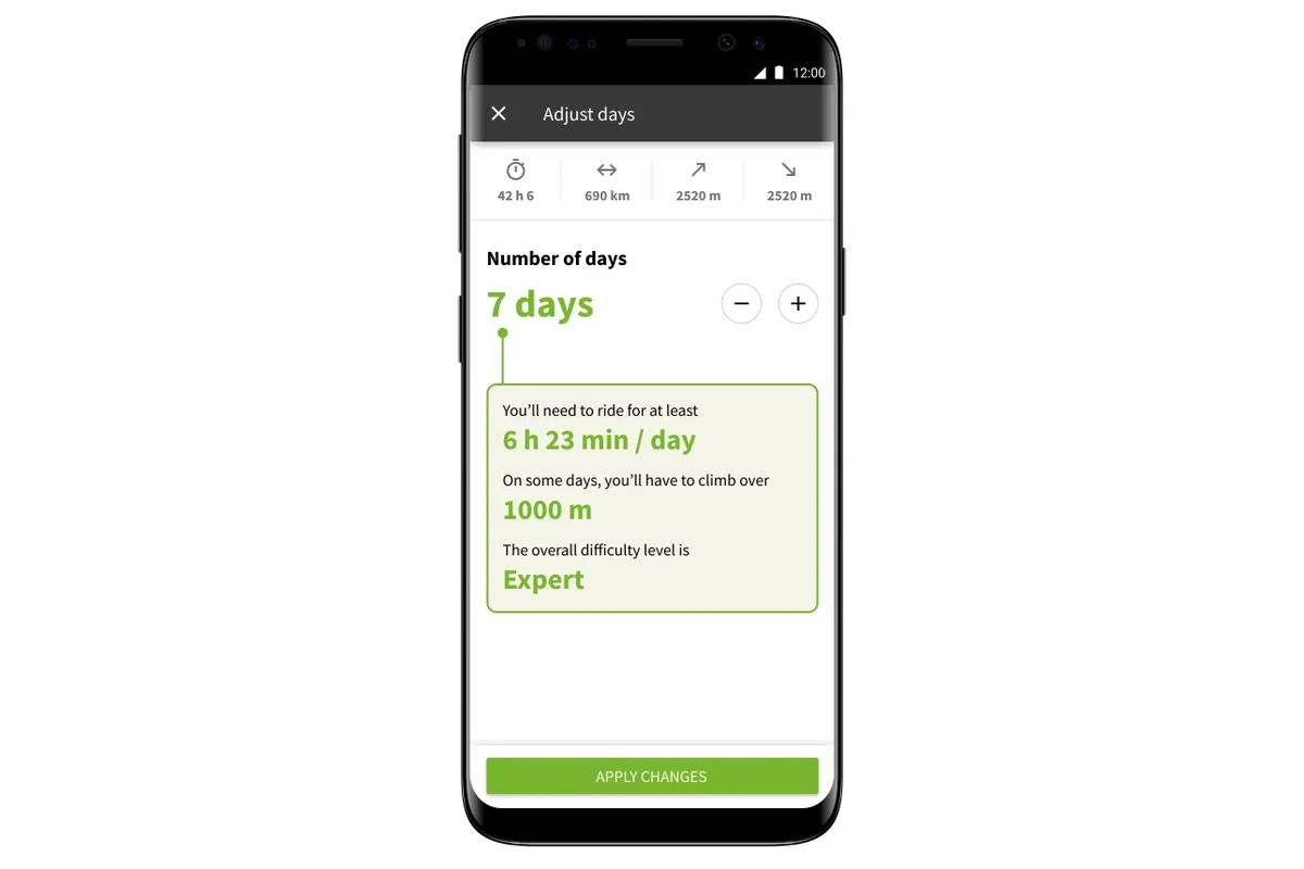
The Premium service includes maps, and if you have already unlocked world maps, you can get Premium at a discount price.
Currently, Komoot offers an insurance policy in its Premium package for users in Germany and Austria, and plans to make this available in other countries soon.


